
Oxque beat
Fly & Worm Only
Members and Guests Only (No access to day permit holders)
This part of the river contains only trout therefore there is
NO FISHING from 1st October until 25th March.
Species
Brown Trout.
All fish to be returned unharmed.
Fly Fishing
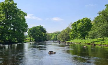
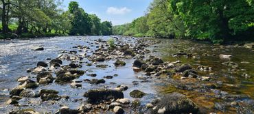
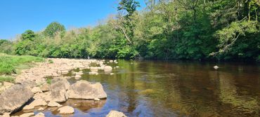
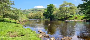
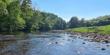
1.8 km of excellent fly fishing. There are deep pools, glides and riffles. A great mix of different types of water. Some sections have a lot of bank side trees, others are very open.
No Coarse Fishing
No Night Fishing
Map
Click the image above or the link below to view on Google Maps. Click on each peg number for W3W locations.
Parking and access
Parking at bridge
Parking at bridge
Parking at bridge

Turn off the A6108 and cross Downholm Bridge. There is space to park at the side of the road on the left. Walk back to the bridge which is the bottom limit.
Parking at bridge
Parking at bridge
Parking at bridge
Go over stile on the downstream side and go under the bridge arch to begin fishing and work your way upstream. This is only possible in low water conditions.
Lay-by Parking
Parking at bridge
Lay-by Parking
You can drive further up the road from the bridge and park in the lay-by on left hand side just before the road bends to the right. Walk from the lay-by towards the bend in the road. Go through the gate on the left to access the river. This photo is taken looking back towards the bridge.
Gate to farm
Gate to farm
Lay-by Parking
Entrance to the private road leading to Oxque Farm. If you have parked in the lay-by you can go through the gate and walk to the river. Alternatively you may want to drive to the anglers parking area which is further down the farm road.
Close the gate behind you!
Lane
Gate to farm
Second gate
Drive down the lane with the river on your left. Drive slowly as there are usually sheep in the fields either side. Keep going until you come to the second gate.
Second gate
Gate to farm
Second gate
Go through the second gate. The parking area is on your left immediately after the gate.
Close the gate behind you!
Parking area
Read the signs
Read the signs
The designated parking area is on the left after you come through the gate. Space for three cars. Please park sensibly and leave space for other vehicles. Do NOT drive beyond this point.
From the parking area walk to the river by bearing left and following the track.
Read the signs
Read the signs
Read the signs
The parking area is signed and there are several other signs warning anglers not to drive any further up the track. Please observe these instructions.
Private
Read the signs
Private
There is no public right of way on this land. You should not meet any walkers or members of the public. If you do please be polite and advise them that they are on private land and request that they leave.
Path
Top limit
Private
There is a well worn path along the river bank. There is one wooden fence to climb over between the parking area and the top limit.
Top limit
Top limit
Top limit
To reach the top limit you will need to walk across a very big open field. The wood at the far side is the boundary. You will see out top limit sign on the fence at the edge of the wood.
Photo Collection
.jpg/:/cr=t:0%25,l:0%25,w:100%25,h:100%25/rs=w:370,cg:true)
.jpg/:/cr=t:11.59%25,l:20.23%25,w:60.05%25,h:60.05%25/rs=w:370,cg:true,m)
.jpg/:/cr=t:0%25,l:0%25,w:100%25,h:100%25/rs=w:370,cg:true)
.jpg/:/cr=t:8.7%25,l:23.63%25,w:60.05%25,h:60.05%25/rs=w:370,cg:true,m)
.jpg/:/cr=t:0%25,l:0%25,w:100%25,h:100%25/rs=w:370,cg:true)
.jpg/:/cr=t:0%25,l:0%25,w:100%25,h:100%25/rs=w:370,cg:true)