Richmond & District Angling Society

Call or Text 07742 300881

  • Home
  • Contact
  • Membership
  • Day Permits
  • Beat Maps
  • Rules
  • Report
  • Catch Returns
  • News
  • Get Involved
  • What's On
  • Articles
  • Gallery
  • River Levels
  • Safety
  • Useful Links
  • Constitution
  • Clubmate
  • Sitemap
  • Policies and Procedures
  • Club Events
  • Exchange Tickets
  • Biosecurity
  • D'Arcy Hildyard Water
  • D'Arcy Hildyard Lakes
  • More
    • Home
    • Contact
    • Membership
    • Day Permits
    • Beat Maps
    • Rules
    • Report
    • Catch Returns
    • News
    • Get Involved
    • What's On
    • Articles
    • Gallery
    • River Levels
    • Safety
    • Useful Links
    • Constitution
    • Clubmate
    • Sitemap
    • Policies and Procedures
    • Club Events
    • Exchange Tickets
    • Biosecurity
    • D'Arcy Hildyard Water
    • D'Arcy Hildyard Lakes

Call or Text 07742 300881

Richmond & District Angling Society
  • Home
  • Contact
  • Membership
  • Day Permits
  • Beat Maps
  • Rules
  • Report
  • Catch Returns
  • News
  • Get Involved
  • What's On
  • Articles
  • Gallery
  • River Levels
  • Safety
  • Useful Links
  • Constitution
  • Clubmate
  • Sitemap
  • Policies and Procedures
  • Club Events
  • Exchange Tickets
  • Biosecurity
  • D'Arcy Hildyard Water
  • D'Arcy Hildyard Lakes

Iron Banks Wood

There are some good locations for both fly fishing and coarse fishing on this beat. It holds plenty of grayling and trout. Chub and barbel can also be found. You will need to explore to find the best locations. 

Iron banks wood beat

Fly and Coarse Fishing

Any legal method allowed. All fish to be returned unharmed. 


Approximately 412m (0.25 miles).


Species

Trout, Grayling, Chub, Barbel, Dace, Pike.


Fly fishing.

There is some good fly fishing on the lower section of peg 10 and down to  The Sand Hole.


Coarse Fishing

Peg 10 and The Sand Hole are all good locations to try. 

Map

Click the image above or the link below to view on Google Maps. Click on each peg number for W3W locations. 

Google Maps

Iron Banks : Pegs 10

Parking

Peg 10: Top

Parking

There is parking adjacent to the sewage works, on the south bank of the swale just below Easy bridge. This can be accessed from the Richmond to Catterick road, about a mile beyond "The Station", on the left hand side. 

what3words reference: rocky.headliner.campsites

Parking

Peg 10: Top

Parking

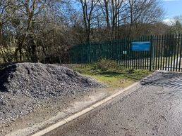
Another view of the parking, showing the sewage station sign in blue. Be warned, it can get rather pungent around here.....

Peg 10: Top

Peg 10: Top

This is the top of peg 10, which is just behind the sewage station. There is a narrow path behind the railings to navigate, which can be quite overgrown in summer.It can be a good spot for barbel, grayling and trout.

what 3words reference: swarm.somebody.wipes

Style

As you walk downstream from Peg 10, you will come to this style which takes you away from the river into the adjacent field.

Downstream Access

Downstream Access

There is a gate followed by a small footbridge to access the downstream part of the peg. Be careful as you proceed downstream as there is significant Bankside erosion.


Copyright © 2023 RADAS

  • Home
  • Contact
  • Beat Maps
  • Rules
  • Report
  • Catch Returns
  • River Levels
  • Safety
  • Constitution
  • About
  • Sitemap
  • Fish Welfare
  • Award Form

Powered by

Cookie Policy

This website uses cookies. By continuing to use this site, you accept our use of cookies. Privacy Policy

DeclineAccept & Close