Green Bridge Waters
Fly & Worm Only
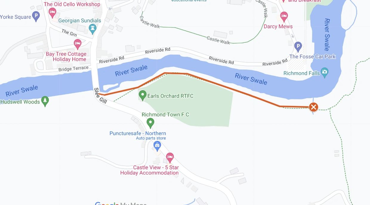
South bank from Green Bridge nearly to The Falls. There is a bottom limit sign on a tree next to the footpath.
There is free parking on The Green or paid parking at York Square car park.
Beat length approximately 400m (0.2 miles).
All fish to be returned unharmed.
Species
Brown Trout.
Map
Click the image above or the link below to view on Google Maps. Click on each peg number for W3W locations.
Access
Green Bridge
Green Bridge
Green Bridge

Our fishing starts at the bridge not the top limit sign. It is possible to access the river from the footpath leading from the main road.
Underpass
Green Bridge
Green Bridge

Follow the footpath with the river on your left and the sports field on your right. You will come to a low stone wall either side of the path. Use the underpass to get to the river bank.
Upstream
Green Bridge
Downstream

Upstream of the underpass.
Downstream
Riverside footpath
Downstream

Downstream of the underpass.
Riverside footpath
Riverside footpath
Riverside footpath

The footpath goes beside the river from Green Bridge to Mercury Bridge.
View of the Falls
Riverside footpath
Riverside footpath

View of the Falls from our bottom limit sign. Our fishing stops upstream of the Falls.
Bottom Limit
Bottom Limit
Bottom Limit

There is a bottom limit sign on the tree above the bench where the path climbs to the right.
Copyright © 2023 RADAS

Early Bird Offer!
2026 memberships will be on sale from 14th March after the AGM.
NO PRICE INCREASE
NO JOING FEE
If you pay before 14th April.
Cookie Policy
This website uses cookies. By continuing to use this site, you accept our use of cookies. Privacy Policy

