Great langton beat
Fly and Coarse Fishing
Any legal method allowed. All fish to be returned unharmed.
Great Langton beat length approximately 2km (1.2 miles)
Species
trout and grayling, dace, barbel and chub
Fly fishing
Pegs 1,2, 3, 5, 6, 8 & 15 are all potentially good for fly.
Coarse Fishing
All pegs depending on water conditions.
Map
Click the image above or the link below to view on Google Maps. Click on each peg number for W3W locations.
Great Langton: Pegs 1 to 15
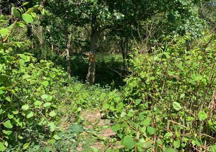
Japanese Knotweed
Japanese Knotweed
Japanese Knotweed

There is a major infestation of Japanese Knotweed on this beat.
Do not cut down the plant.
Thoroughly clean your boots, clothing and equipment before leaving the river at great langton to ensure no seeds or segments of plant are taken away with you.
Japanese Knotweed is highly invasive and destructive if it gets near to buildings.
STOP THE SPREAD!
Japenese Knotweed is not harmful to humans but you do not want it in your garden or near your property.
Identification
Japanese Knotweed
Japanese Knotweed
What is Japanese Knotweed?
Japanese knotweed is a very tall plant with large triangular leaves, hollow, red stems that are a bit like bamboo, and small, white, tufty flowers that appear in late summer and autumn.
New growth appears as rapidly growing soft red/purple shoots reminiscent of asparagus spears, growing into stronger, upward shoots with hollow stems that look like bamboo and can grow up to 10cm per day. This new growth forms dense thickets, known as stands. The emerging leaves grow on alternate sides of the stem producing a zig-zag pattern in the stem, with a leaf shooting from each ‘zig’ and each ‘zag’.
What you can do
Japanese Knotweed
Carry a small brush with you so that you can remove any seeds or particles from your clothing and equipment.
A small spray bottle is also useful to enable you to clean your boots before leaving.
We must all play our part in stopping the spread.
For more information about Japanese Knotweed go here:
https://anglingtrust.net/wp-content/uploads/2020/03/ID_Fallopia_japonica__Japanese_knotweed_.pdf
Parking
Upstream Limit / Peg 1
Parking at Great Langton is in a lay-by on the north side of the river. Adjacent to the bridge.
RADAS members are requested to park on the upstream side to allow Kirkby Fleetham anglers space to park in the lay-by on the downstream side.
Parking is not allowed on the south side of the bridge
what3words :overused.interview.contact
Upstream Limit / Peg 1
Upstream Limit / Peg 1
Upstream Limit / Peg 1
The old railway carriage marks the top limit of RADAS water on the south bank. It is clearly signed.
This is also the top of Peg 1.
It is is a 20-30 minute walk from the the bottom limit (the bridge) to the top limit.
what3words : blockage.awaken.massive
Peg 1 High Bank
Upstream Limit / Peg 1
Upstream Limit / Peg 1
Access to peg 1 is through a gap in the barbed wire fence, a few yards below the peg itself. The banks are high and steep here and great care should be taken especially in wet conditions - there are many concrete/stone slabs on the bank covered in moss which are very slippery in wet conditions. There is a fast riffle at the top of the peg and deep water close to the near bank. Peg 1 is about 300 mtrs long.
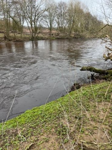
Peg 2
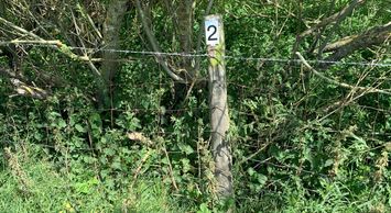
Follow the fence line about 300 mtrs downstream and you'll find peg 2. The access is about 25 yards below the actual peg, again through a gap in the barbed wire (be careful!).
what3words:
radically.reach.juggle
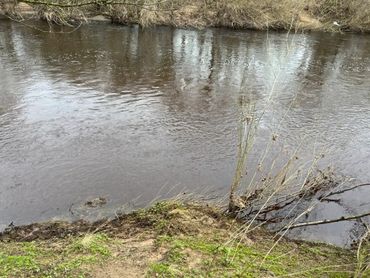
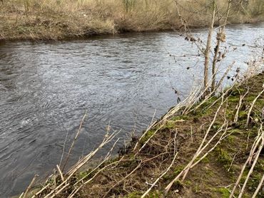
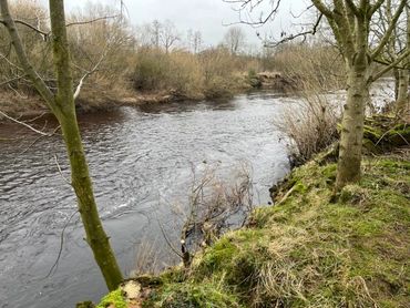
Peg 2 River View
This is a picture of the river taken when the river was very low. There is a fast riffle towards the bottom of the peg (not shown in photo).
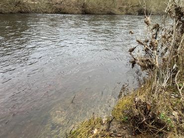
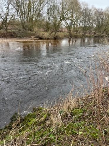
Peg 3
Peg 3 River View
Peg 3 Access
Continue downstream along the fence line to peg 3.
what3words : remit.meatballs.ruffling
Peg 3 Access
Peg 3 River View
Peg 3 Access
Access is through the gap in the barbed wire fence. The peg numbers are in the background of this photo.
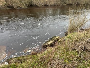
Peg 3 River View
Peg 3 River View
This is taken at river level when the river was very low.
Peg 4
The actual peg is on a silver birch tree which is in line with the farm gate in the adjoining field.
what3words :
sings.face.steady
Peg 4 Farm Gate
Peg 4 Farm Gate
This is the farm gate referred to in prior photo; the silver birch tree with the peg on it can be seen in the background.
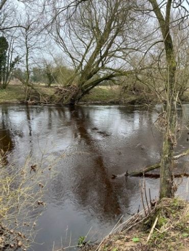
Peg 4A

The next peg is 4A. We assume there was a re-pegging at some time that necessitated the "A" designation.
what3words : squirts.regrowth.clay
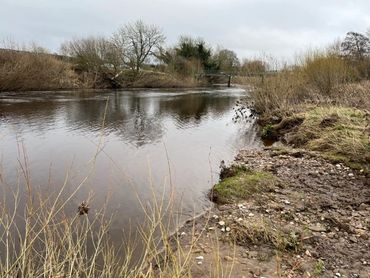
Peg 4A River View
There is everything here a fish could wish for - cover, oxygen, flow and slack water i.e. lots of complex current flows.
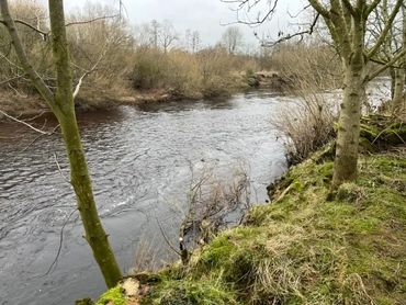
Peg 5
Peg 5
Peg 5
Peg 5 is mostly shallow glides. Could be a good spot when the river is at normal level or carrying a little for trout/grayling on the fly?
what3words : manly.stone.perfect
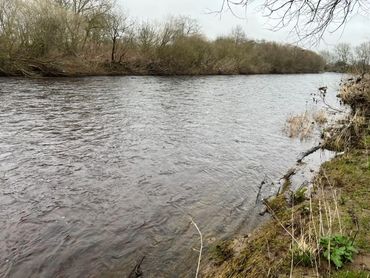
Peg 6
Peg 5
Peg 5
Peg 6 is about 100 yards below peg 5 and above peg 7.
what3words : pylon.downs.awakening
Peg 6
Peg 6
Peg 6
Access to Peg 6.
Peg 6
Peg 6
Peg 6
A beautiful section of water with riffles, deeps, slacks and lots of structure provided by an old, collapsed bridge in the river.
Peg 7
Peg 7
Peg 7
what3words: arrived.presuming.rental
Peg 8
Peg 7
Peg 8 and what used to be Peg 9.
what3words: refuse.elections.inches
Peg 8/9
Peg 8/9
Picture to be updated as this section has changed.
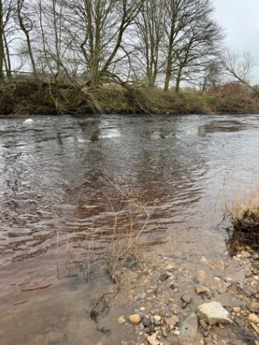
Peg 10
Peg 10
Peg 10
Peg 10 - very shallow water when river is low.
what3words: uttering.gangway.workflow
Peg 11
Peg 10
Peg 10
Peg 11 - shallow water when the river is low with a steep bank, so take care when accessing! The easiest way to get down is about 50 yards below the actual peg.
what3words: widget.rational.delays
Peg 12
Peg 10
Peg 12
Peg 12 - similar to peg 11
what3words: shot.kick.ounce
Peg 13
Peg 13
Peg 13
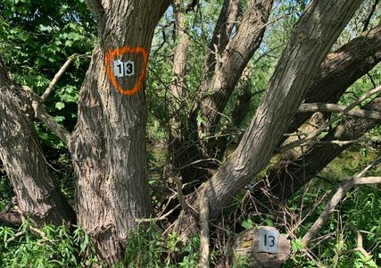
Peg 13
what3words : hails.remind.backpacks
Peg 14
Peg 13
Peg 13
Peg 14
what3words : longer.olive.receiving
Peg 15
Peg 15 is the last peg on R&DAS Great Langton water (it is the most downstream peg). It is unique in that it cover both sides of the river (all of the other pegs are South side only). Be careful if you do access the North side (closest to the main road) - the banks are steep and overgrown.
what3words : rotation.huddling.gained
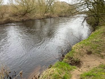
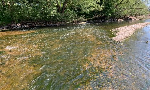
Peg 15 River View
This shows peg 15 when the river was low.
Photo Collection