
brompton on swale beat
Fly Fishing and Coarse Fishing
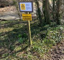
Any legal method allowed. All fish to be returned unharmed.
Beat length North Bank approximately 500m (0.3 miles).
South Bank approximately 1.12km (0.7 miles).
Species
Trout, Grayling, Chub, Barbel, Dace, Pike.
Fly fishing
There are good fly fishing stretches on both banks.
Coarse Fishing
Most pegs depending on water conditions.
Map
Click the image above or the link below to view on Google Maps. Click on each peg number for W3W locations.
Brompton-on-swale: Pegs 28 to 35
North Bank Parking

Park in the layby on the right hand side of the B6271 just before entering Brompton-on-Swale from Richmond. This is a picture of the council land area immediately in front of the layby
what3words reference: piglet.wound.penned
North Bank Access from B6271
Walk upstream along the side of the road about 200 yards until you come to the B6271 road-bridge over Skeeby Beck. The water is accessed by a walking path along the side of Skeeby Beck, just before it enters the north bank of the Swale
what3words reference: puddings.dined.coast
North Bank Top Limit: Bailey Bridge
North Bank Top Limit: Bailey Bridge
Follow the path upstream from where Skeeby Beck enters the Swale up to the top limit at the "Bailey Bridge".
MEMBERS ARE ADVISED NOT TO WALK OVER THE BAILEY BRIDGE
to access the south bank. There are holes in the planks and some planks are missing.
Anyone using the bailey bridge does so at their own risk.
The official access to the south bank is from St Giles Farm.
Peg 28
North Bank Top Limit: Bailey Bridge
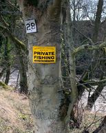
Peg 28 starts immediately below the Bailey Bridge. There is some really good grayling fishing here, with the chance of a real specimen.
what3words reference: blesses.spectacle.pity
Peg 29
Peg 29 is a long peg, with some thin water at normal river level
what3words reference: willpower.angel.unzipped
Peg 30
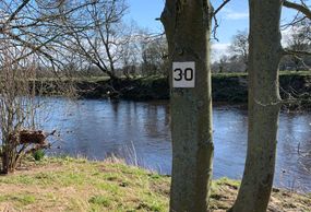
A much shorter peg due to deep holes for chub and barbel.
what3words reference:
cabbies.bronzer.motel
Peg 31
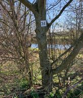
Another short peg with some great chub holes and a match winning peg on many occasions.
what3words reference:
priced.digital.snippets
Peg 32
The last peg on this section, and runs all the way down to Skeeby Beck entrance. Thinner water here, hence the length of the peg, but also some deeper holes at the top of the peg.
what3words: snooty.basics.slip
Warning: Power Lines
North Bank Lower Limit
There are overhead power lines at the top of peg 32, so take care with carbon rods and poles and remember that electricity can arc, so you do not have to tough the power lines to be electrocuted.
North Bank Lower Limit
North Bank Lower Limit
Skeeby Beck entrance is the end of our north bank fishing. Don't forget the south bank fishing goes beyond this (see maps) and can be accessed via the Bailey Bridge, wading shallow sections of the river when conditions are appropriate (always use a wading staff) or by parking at St Giles Farm...
South Bank Parking at St Giles Farm
South Bank Parking at St Giles Farm
UPDATE 28TH MAY 2023:
Access St Giles Farm from the A6136 towards Catterick Garrison. Parking is on the gravel area highlighted above. Please DO NOT BLOCK FARM ACCESS.
W3W reference: To be confirmed
South Bank Parking at St Giles Farm
South Bank Parking at St Giles Farm
UPDATE 28TH MAY 2023:
Parking is also available on the gravel to the right hand side as shown above.
DO NOT BLOCK FARM ACCESS.
South Bank St Giles Farm Gate Access
Having parked your vehicle on the grass verge at St Giles Farm, walk about 75 yards towards the farm house and you will come to this gate. There is a public footpath to the left of the gate, but you should proceed down the main farm track, which is straight ahead in this photo. A 5-10 minute walk following the track will take you to the south bank of the Swale, about 2/3 of the way up the beat (i.,e, closest to the Bailey Bridge).
W3W reference: range.smiles.sweetened
South Bank Peg 33

Peg numbers on the South Bank are marked with orange paint on rocks as there are no convenient trees. To avoid double-bank pegging, the first peg on the south side is 33, which is just downstream of where Skeeby Beck enters the Swale on the Northside.
South Bank Peg 34
South Bank Peg 34
Peg 34 is the next downstream peg, look for the house on the far bank to locate.
South Bank Peg 35
South Bank Lower Limit
South Bank Peg 34
The last peg on this section is 35, opposite thee stone wall on the far bank. This peg goes down to the lower limit.
South Bank Lower Limit
South Bank Lower Limit
South Bank Lower Limit

The lower limit sign is on the fence.